Crop Field Boundary Detection
Automatic Farm Boundary Detection or Crop Field Delineation
Efficient Crop Field Delineation Services
Map My Crop is a cutting-edge software platform offering automated farm boundary detection and crop field delineation services. Utilizing advanced machine learning and computer vision algorithms, Map My Crop can automatically identify and map the boundaries of farms or crop fields from remote sensing data, including satellite images and aerial photographs.
Importance of Accurate Land Boundary Delineation
Accurately delineating land boundaries is essential for effective land-use identification and management planning. For croplands, precise boundary detection allows farmers and agribusinesses to:
- Better estimate land area
- Efficiently use agricultural inputs like seeds, pesticides, and fertilizers
- Optimize production and post-production activities
Cost-Effective and Accurate Solutions
Map My Crop’s automated farm boundary detection platform offers a cost-effective, accurate solution to boundary delineation challenges. By automating the boundary detection process, farmers and land use planners can save time and resources, resulting in more reliable boundary maps.
REQUEST SAMPLE BOUNDARY DATASETS
ONBOARD CUSTOMER FASTER
For any agtech application, you need customer’s farm filed to perform your service, while the drawing tools and upload features are cumbersomnme and old, with out API or white label version, your customer adds new filed in seconds without any pain.
NO WORRY OF GEOFILE FORMATS
Stop wondering which format your customer could upload his filed boundary to your systems, our field boundary api supports more than 10+ gis formats including esri shapefile, geojson, kml & so on. We have your covered with all formats including custom ones.
ACCURATE FARM BOUNDARIES
Where machines or drones, the geometry needs to accurate to be useful. We provide over 97% accurate automatically detected filed boundaries.The Model use for CFBs detection is custom build and we have over 100+ tailored to different geographic & countries.
SMALL FARMS AUTOMATED CROP FIELD BOUNDARY DEMO
Our Automated Crop Field Boundary Detection not only works for big farms, but also works for small farms less than acre as well. This is an Example for an Indian Farms
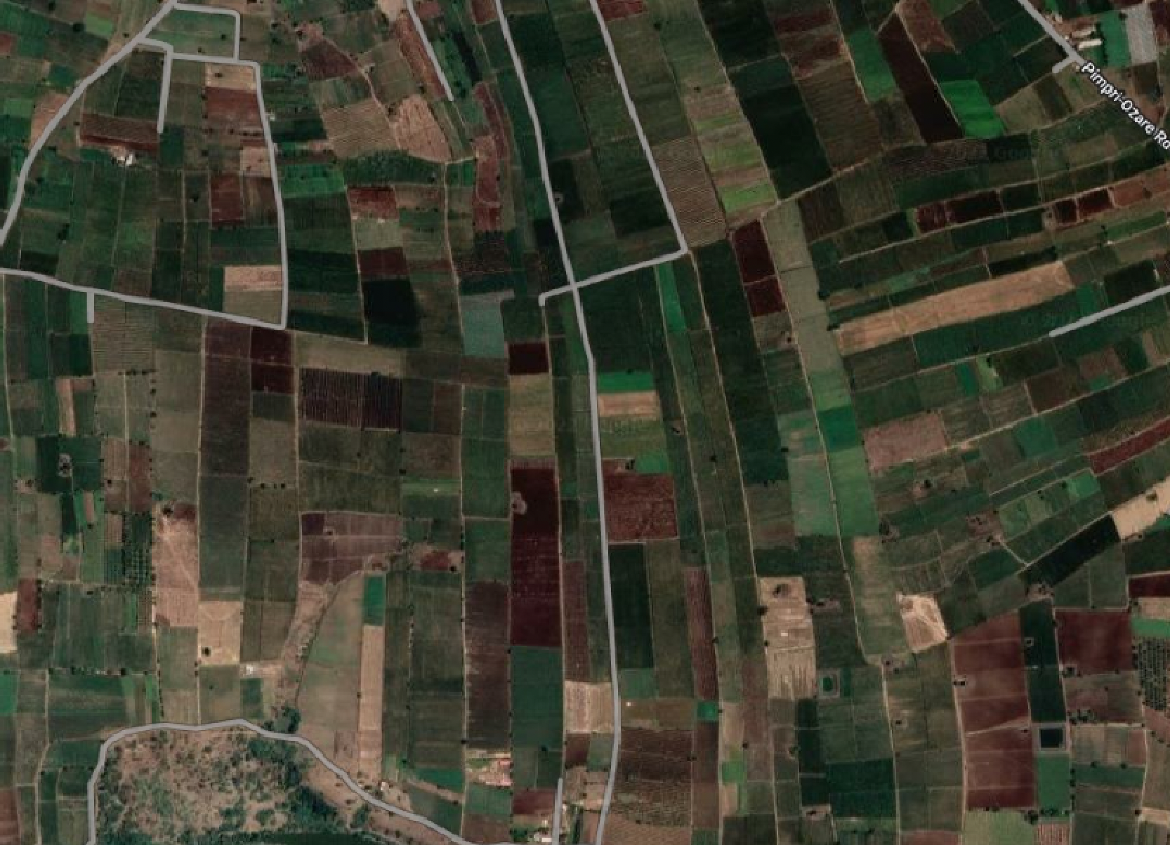
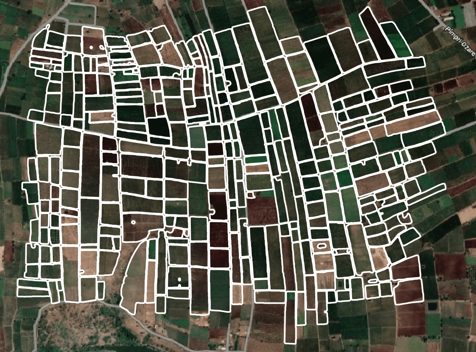
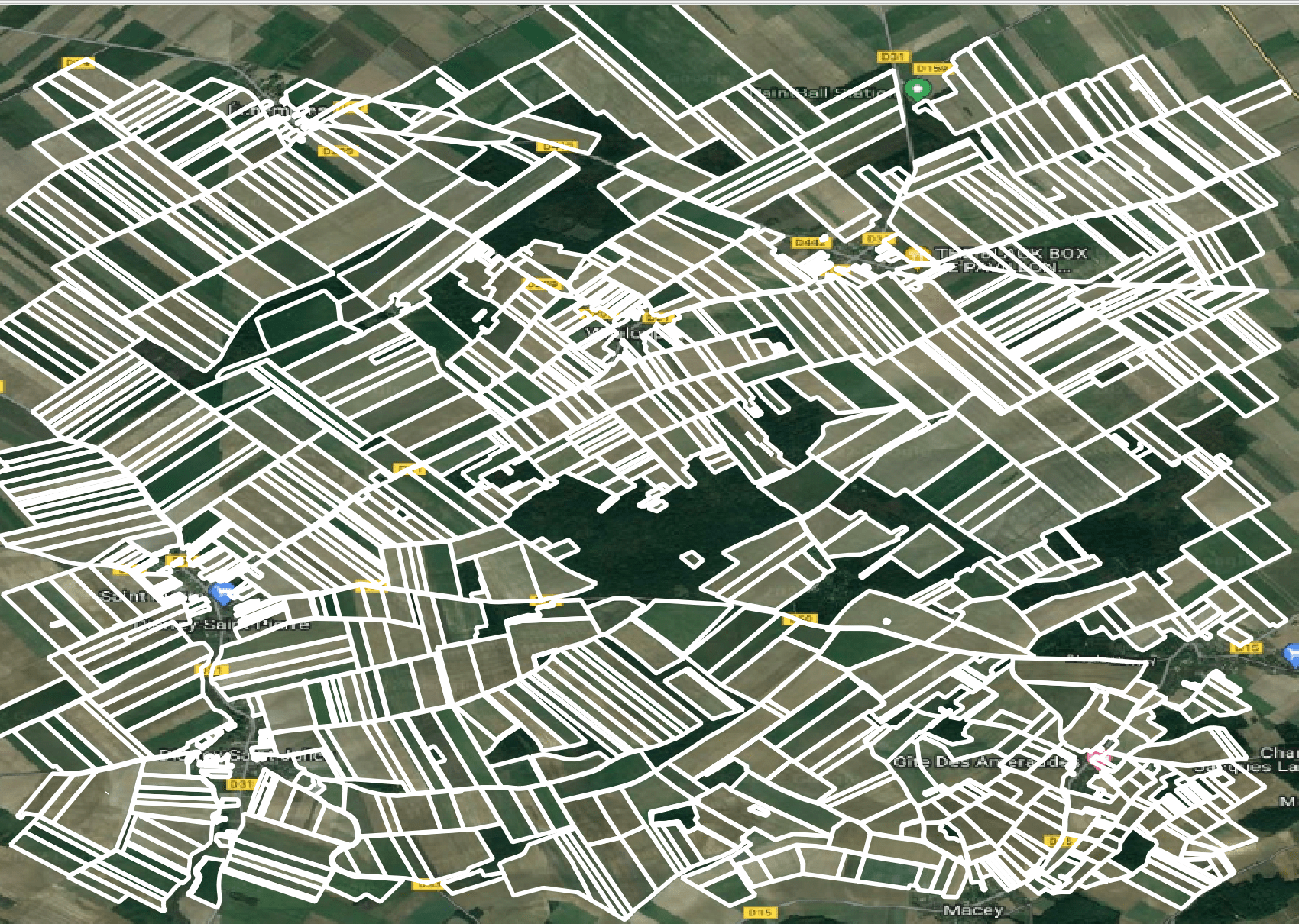
LARGE FARMS AUTOMATED CROP FIELD BOUNDARY DEMO
Our Automated Crop Field Boundary Detection not only works for big farms, but also works for small farms less than acre as well. This is an Example for an European Farms

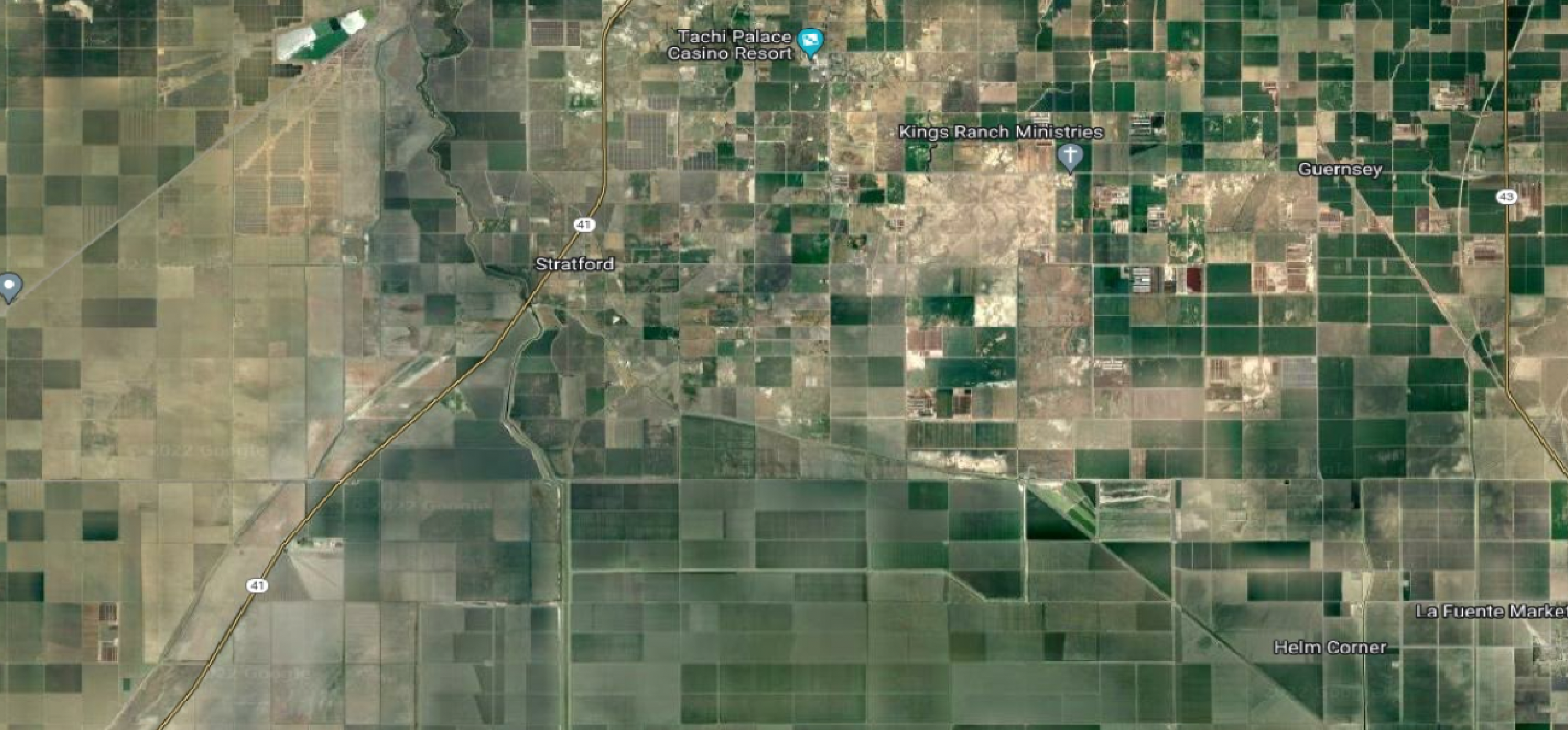
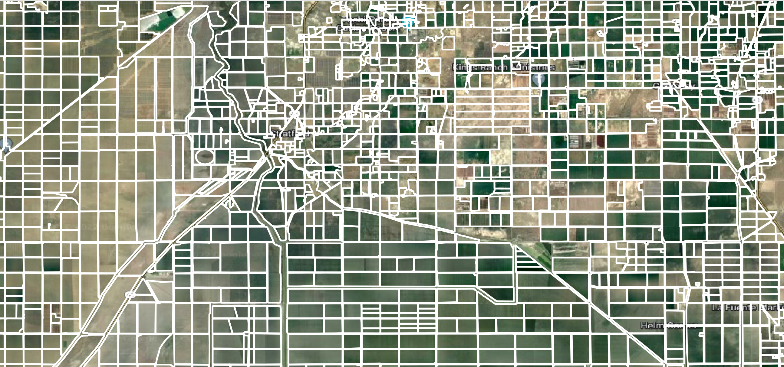
MIXED FARMS AUTOMATED CROP FIELD BOUNDARY DEMO
Our Automated Crop Field Boundary Detection not only works for big farms, but also works for small farms less than acre as well. This is an Example for an USA Farms