360° Agro Suite

14 MapMyCrop products, one platform.

MapMyCrop is a satellite and AI agriculture monitoring platform. Its 360° Agro Suite helps farms, plantations, insurers, lenders and governments map land, monitor crops and trees, and anticipate risk, in three stages: Get Digital, Get Optimised and Get Ahead. Each of the 14 products works on its own, or together as one suite on a shared platform with one login, one data model and one API.

7M+
Farmers Served
350+
Crops Supported
95%
Platform AI Accuracy
80+
Countries
2,000+
AI Models
15+
Years of Data
Our Philosophy

One platform, not fourteen separate tools.

MapMyCrop is built as one intelligence layer, not a bag of separate tools. Your boundary data makes crop monitoring smarter, monitoring makes yield forecasts more useful, and forecasts feed risk scores. Start with one product. Add more as you need them.

Standalone or Suite — Your Choice
Every product works on its own. No forced bundling.
One Shared Intelligence Core
All 14 products run on one shared satellite and AI platform, so insights build on each other instead of duplicating.
One API for Everything
One integration for all 14 products. White-label options are available for platform builders.
The platform in numbers
Disease detection water stress yield prediction risk scoring
Every product draws on the same platform: satellite and drone data, AI models, one login, one data model and one API.
2,000+
AI models trained on agricultural satellite data, not generic ML
350+
Crops supported across the platform
80+
Countries where MapMyCrop is used
15+ yr
Years of agricultural data behind the models
Showing all 14 products

Each product works on its own, or together as one suite

Start with the product that solves your most urgent need. Add more and they share the same platform: one login, one data model and one API.

Standalone Ready API Integration White Label
01

Farm Foundation

Know what land you have and what is growing on it. The base every other product builds on.

Get Digital
Get Digital Live

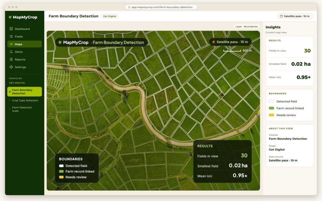
Farm Boundary Detection

Maps farm and field boundaries automatically from satellite imagery, down to 0.02 ha, with per-field attributes and a 10-year archive. Automatic delineation, no surveys Land-record linking in 40+ countries CSV, GeoJSON, KML and shapefile export

Outputs
  • Field polygons
  • Area and confidence
  • Boundary versions
Learn more
Get Digital Live

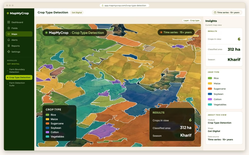
Crop Type Detection

Identifies the crop in each field from radar and optical satellite data, with per-parcel confidence, acreage by crop and a declared-vs-detected audit. Field-by-field classification Acreage by crop and rotation history FSMA 204 traceability support

Outputs
  • Crop label per field
  • Acreage by crop
  • Sowing and harvest dates
  • Audit flags
Learn more
Get Digital Live

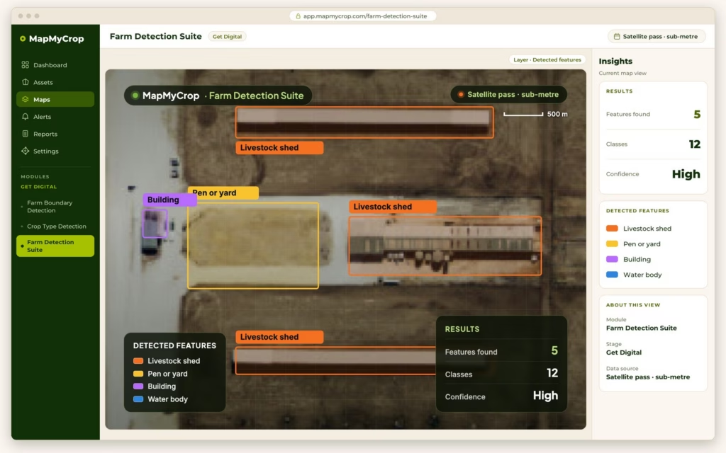
Farm Detection Suite

Detects disease, pests, crop damage and farm features such as buildings, ponds, CAFOs, trees and animals from satellite imagery, with dated evidence for claims. Early stress and pest signals Crop damage by hail, flood, frost, fire Automated claim verification

Detection signals
  • Stress and pest signals
  • Damage area
  • Farm features
  • Claim verdict
Learn more

Not sure where to start?

Book a demo and we will match the right products to your operation.

Book a demo
02

Smart Operations

See performance live and act on it. Six monitoring products for farms, crops, plantations, oil palm, urban trees and forests, plus drone detail and water decisions.

Get Optimised
Get Optimised Live

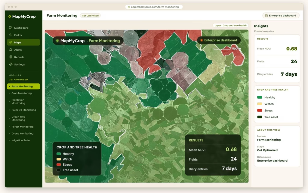
Farm Monitoring

Tracks crop and tree health across farms that grow both, in one view, with a farm diary for activities, equipment and cost. Crop and tree health maps Stress alerts and scouting Farm diary and enterprise dashboard

Outputs
  • Crop health
  • Tree health
  • Change alerts
  • Activity log
Learn more
Get Optimised Live

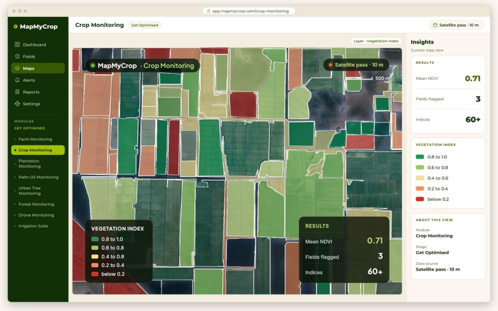
Crop Monitoring

Monitors crop health field by field with 60+ satellite indices, hyperlocal weather, advisories by app, WhatsApp, SMS and voice, scouting, VRA maps and photo-based disease detection. For crops only. 60+ precision map layers Hyperlocal weather under 100 m Photo-based disease detection

Data signals
  • NDVI
  • NDWI
  • EVI
  • LAI
Learn more
Get Optimised Live

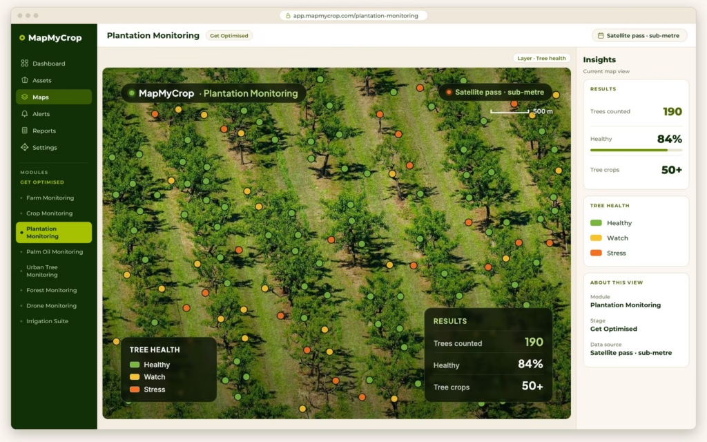
Plantation Monitoring

Monitors orchards and tree crops block by block, with individual-tree health from satellite imagery alone. 50+ fruit trees, orchards and other tree crops. Block and tree health maps Tree counting and gap maps Vigour zones for pruning and nutrition

Outputs
  • Canopy area
  • Tree count
  • Stress index
Learn more
Get Optimised Live

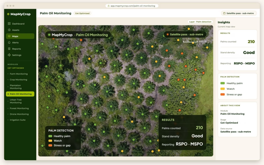
Palm Oil Monitoring

Monitors oil palm estates palm by palm: inventory and QR tagging, health scores, bunch counting and ripeness, FFB weight forecasts, harvest planning and fire watch. RSPO and MSPO compliant. Palm count, gaps and age Bunch counts and ripeness Fire alerts and burn-free reports

Outputs
  • Palm inventory
  • Health score
  • FFB forecast
  • Fire alerts
Learn more
Get Optimised Live

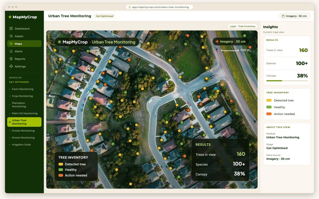
Urban Tree Monitoring

Detects, counts and scores every tree in a city or estate from imagery MapMyCrop supplies, with species identification validated for 100+ species in MENA and Asia. Tree detection and inventory Health scores and canopy cover Reports and GIS export

Outputs
  • Tree inventory
  • Species
  • Health score
  • Canopy cover
Learn more
Get Optimised Live

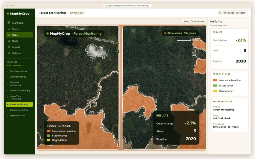
Forest Monitoring

Tracks forest cover and change over time: deforestation alerts, fire monitoring, reforestation tracking and evidence for compliance reporting. Deforestation and fire alerts Reforestation and species maps Carbon and biomass estimates

Data signals
  • Forest cover
  • Change alerts
  • Fire hotspots
Learn more
Get Optimised Live

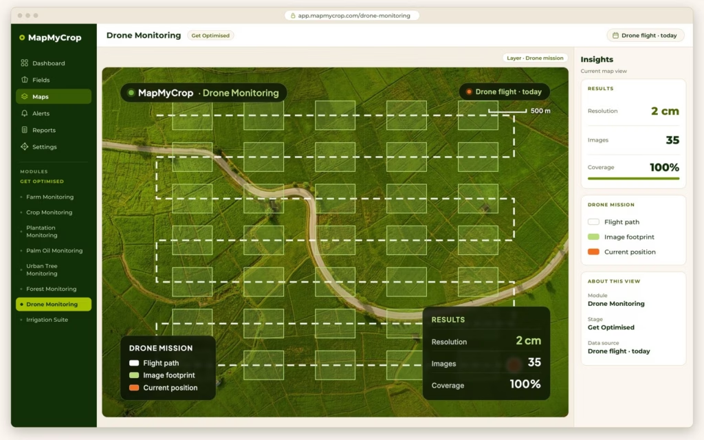
Drone Monitoring

Turns your own drone imagery into orthomosaics, 3D models, plant counts, weed and damage maps. Software only, with local drone partners recommended. Orthomosaics and elevation models Plant counting and planting gaps Weed, disease and damage maps

Outputs
  • Plant stand count
  • Canopy coverage
  • Weed pressure
  • Damage map
Learn more
Get Optimised Live

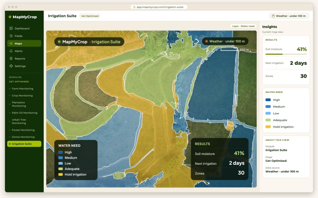
Irrigation Suite

Decides when and how much to irrigate, field by field, with zone-wise water volumes, fertigation schedules and an Irrigation Efficiency Rating from 0 to 100. Water stress and moisture maps Zone-wise irrigation and fertigation plans Irrigation Efficiency Rating

Data signals
  • ET actual
  • Soil moisture
  • Crop water demand
  • Efficiency score
Learn more
03

Command Center

Forecast outcomes, measure exposure and report from one view, with an enterprise dashboard across every product you own.

Get Ahead
Get Ahead Live

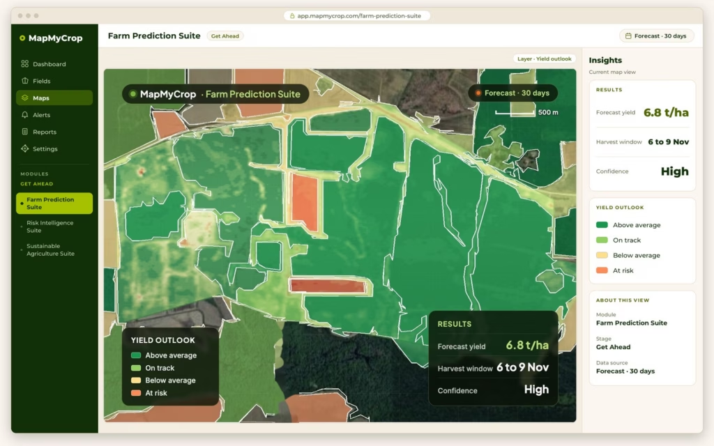
Farm Prediction Suite

Forecasts yield, harvest timing and crop area from satellite data, weather and history, with risk flags and scenario planning. Yield estimate with a range Harvest and sowing windows Crop area and biomass

Prediction models
  • Yield estimate
  • Harvest date
  • Crop area
  • Risk flags
Learn more
Get Ahead Live

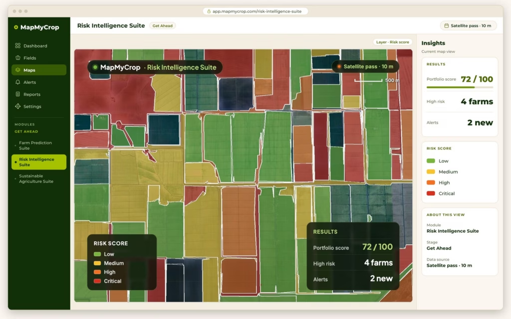
Risk Intelligence Suite

Farm scores, loan monitoring, claims validation, climate risk analysis and parametric insurance support for lenders and insurers. Farm score with factor profile Post-disbursement monitoring Claims validated from imagery

Risk signals
  • Farm score
  • Early warning
  • Claim evidence
  • Climate risk
Learn more
Get Ahead Live

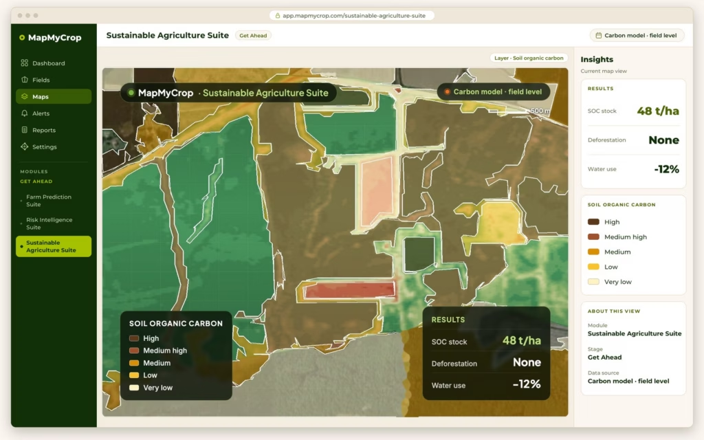
Sustainable Agriculture Suite

Carbon, soil carbon, water, deforestation and practice verification from satellite evidence, packaged for reporting and carbon programmes. Practice verification from imagery Carbon and soil carbon estimates MRV and evidence packs

Reporting signals
  • Carbon footprint
  • Practice flags
  • Deforestation-free
  • Water use
Learn more

Not sure where to start?

Book a demo and we will match the right products to your operation.

Book a demo
The MapMyCrop AI Engine

2,000+ AI models, trained on 15+ years of data

Behind every product is a shared AI engine trained on 15+ years of agricultural satellite imagery. From disease detection to water stress, every signal feeds back and makes the engine smarter.

Satellite data streams Multi-source
Weather & climate variables Multi-variable
Crop-specific models 350+ crops
Historical training data depth 15+ years
Satellite and drone imagery Continuous
Explore API Documentation
Disease detection water stress yield prediction risk scoring
Every signal from every product feeds one shared AI engine. One farm. Total intelligence.
2,000+
AI Models
Trained on agricultural data, not adapted from generic ML
350+
Crops Supported
Modelled across the MapMyCrop platform
15+ yr
Years of Data
Agricultural satellite imagery that the models learn from
95%
Platform AI Accuracy
Reported at platform level across MapMyCrop AI models

Deploy One Product. Or All Fourteen.

Every product works on its own from day one. Combine them and each one makes the others more useful.

Standalone Use Cases

One product. Immediate value. No dependencies.

Bank / Lender
Deploy Risk Intelligence alone to bring field-level evidence into loan underwriting. No other products required.
Risk Intelligence
Government / NGO
Deploy Crop Type Detection alone to check what is planted across a programme, field by field.
Crop Type Detection
City or Estate Manager
Deploy Urban Tree Monitoring alone to inventory trees and track canopy health without surveying every tree.
Urban Tree Monitoring
Food Processor
Deploy Sustainable Agriculture Suite alone to track sourcing practices and support EUDR-style supply chain reporting.
Sustainable Agriculture

Combined Suite Power

Multiple products. Compounding intelligence.

Agri-Finance Institution
Farm Boundary, Crop Type and Crop Monitoring feed Risk Intelligence, so underwriting and portfolio decisions use field-level data.
Boundary Crop Type Monitoring Risk Intel
Agro Cooperative
Crop Monitoring, Crop Type Detection and Irrigation give every member farmer a clear picture of their fields, with no hardware to install.
Monitoring Crop Type Irrigation
ESG-Focused Enterprise
Sustainable Agriculture, Crop Monitoring and Irrigation give you field evidence to support water and sustainability reporting.
Sustain Monitoring Irrigation
Full Platform Deploy
All 14 products together run on one platform, one data model and 2,000+ AI models.
All 14 Products 2,000+ AI models

One API. All 14 products. Any platform.

A single REST API integration connects your systems to the MapMyCrop platform. Built for enterprise scale.

REST API Python SDK Webhooks Bulk Export GeoJSON / COG STAC White Label SDK

Ready for 360° Agro Suite?

Start with one product or activate the full suite. Our team will help you choose the right configuration for your use case.

No commitment required Live demo on your own data Enterprise & white-label options A reply from our team