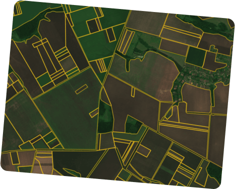
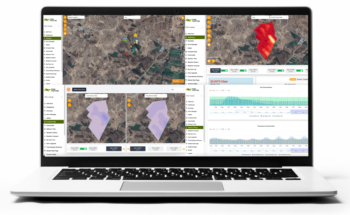
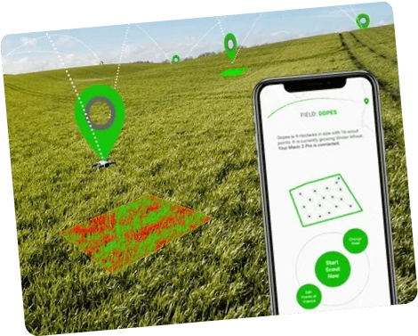
For Cooperatives AgriHoldings

Implementation and Impact

Challenges and Solutions

Our Solution Across Industries

  • Track the vegetation values change using satellite data to decide on the index-based insurance
  • Settle the damage assessment claims quickly and qualitatively using satellite data
  • Maintain a convenient and transparent management of fields and crops in one place by reinsurers and clients alike
  • Make better informed decisions thanks to soil moisture monitoring for individual fields
  • Detect the climate patterns and risks for the area with advanced historical weather
  • Have all your customers and their fields on one convenient platform
  • Stay aware about risks via flexible notification system
  • Reduce costs on scouting with a useful mobile application
  • Identify the most productive fields with our field leaderboard feature
  • Increase profits whilst reducing environmental impact
  • Calculation of the economic effect from the use of VR technology
  • Easely integrate our system with any other systems that you may use
  • Calculate the expected costs allow you to know your costs per zone and per product
  • Calculation of the economic effect from the use of VR technology
  • Automatically scale your logic to all your fields; field alerting and benchmarking
  • Automate alerting
  • Improve your risk management with smart notifications when diseases are spreading into your area.
  • Facilitate the smooth running of multiple systems, platforms or services with API integration
  • View topographic, soil, and yield maps and VRA maps anywhere you need, anytime
  • Increase profits while reducing environmental impact
  • We offer you white label branding with customizations and technology licensing
  • Easely integrate VRA maps, management zones, and imagery views via API
  • Integration into existed business processes and solutions
  • Vegetation Index change alerts help thecustomers focus on the problem areas, and react in a timely manner, thus keeping their crops healthy throughout the season
  • Historical dataon the field’s productivity allows for making accurate predictions of the future yields
  • Creatingscouting reports is super easy: no more paperwork
  • Shared accountallows to notify instantly the assigned scouts about a new task, thus saving time and resources
  • Customers can rate their fieldsaccording to their productivity levels
  • Advancedmonitoring of soil moisture lets users to analyze crops’ state without expensive facility, thus generating better-informed farming solutions at a lower cost
  • Automatic and accurate problem area identificationallows users to save time and resources
  • You can plan field treatment activities more efficiently with a reliable14-day weather forecast
  • Vegetation Index basedproductivity zones identification, which enables more precise and less expensive differential fertilizing, sowing, and drip irrigation, among other activities
  • Save Input Cost
    • Save money with our VRA tool
  • Manage your Data
    • Manage your data even when offline: our mobile app make it possible.
  • Connect with Agri Expert
    • Connet with some of the leading global Agriculture Expert
  • Save Time
    • Save time and money by sending scouts directly to problem areas
  • Keep an Eye
    • Keep an eye on your fields regularly with satellite monitoring and crop rotation data
  • Real Time Updates
    • Enhance future farm activities planning with a 14-day weather forecast for your field
    • Return on Investment
      • Сalculate the expected return on investments through analyzing yield data and as-applied maps
    • Plan it Better
      • Develop a plan that prioritizes what work needs to be done in what order
  • Increase sales with reliable actionable insights from the customer’s field data
  • Create customer loyalty by providing them with a transparent data source
  • Stay updated on any malfunctions, weather risks, and deviations in biomass using a convenient notification system
  • Develop a fertilization strategy thanks to hyper-personolized recommendations based on field-level actionable data.
  • Monitor and manage everything in one place: customer’s fields, weather data, technological operations, and more.
  • Keep in touch with the latest Data Driven Ag technology with a scalable cloud-based solution
  • Scale your business and outreach clients with White Label product (brandable GeoPard software)
  • Maintain customers trust by backing-up the efficacy of your input products, and add value by providing precisionAg recommendations
  • Promote sustainable agricultural land management and make decisions that are better for the planet with precision ag services
  • Manage huge amounts of data over large areas in an automated and time-efficient way

Over 4.1 M Farmers are getting benefit from Smart Crop Monitoring Platform