
Automated tree detection
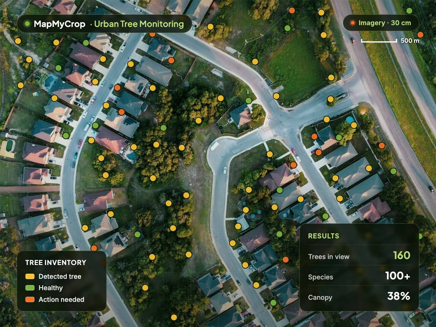
Finds individual trees from high-resolution imagery and places each one as a point on the map, replacing manual surveys.
Map, legend and results in one view.

Urban Tree Monitoring
Monitors non-agricultural trees across cities and estates, one tree at a time. Every tree detected, scored and tracked from high-resolution imagery that MapMyCrop supplies.
Urban Tree Monitoring uses high-resolution imagery supplied by MapMyCrop and AI to detect each tree, identify its species and track crown, health and growth over time. Outputs go into reports, GIS and asset-management systems.
Finds individual trees from high-resolution imagery and places each one as a point on the map, replacing manual surveys.
Location, quantity and status for every tree in one register, kept current as new imagery arrives.
Classifies species across the inventory, validated for 100+ species in the Middle East, North Africa and Asia.
Crown size, shape and colour per tree over time, plus canopy cover per area for urban greening targets.
Stress and disease signals at individual-tree level, with history that shows growth and the effect of earlier interventions.
Health, stress zones and trends as reports and audit evidence, with inventory and scores exported to GIS or asset systems.
Cover and change over time
Detail where satellites stop
Track and report practices
Tree data in your systems
Every tree is counted and mapped from imagery rather than site walks, lowering the survey cost per tree and keeping the register current.
The count and share of trees flagged as stressed or diseased sets the maintenance list, and healthy trees are skipped.
Early signs of water stress or disease at individual-tree level, so crews reach a tree while it can still be saved.
Irrigation schedules per tree zone direct water to the trees that need it. Fertigation is not included for urban trees.
Canopy cover percentage, inventory completeness and health trends as audit evidence for sustainability and compliance reporting.
Tree loss rate and planting survival rate over time show what is working, to plan planting, pruning and replacement.
Urban Tree Monitoring detects and maps individual non-agricultural trees across cities and estates from high-resolution imagery, then scores their health and tracks crown size, species and growth over time. It outputs a tree inventory, per-tree health scores, canopy cover maps and reports.
City councils, municipal parks and urban forestry departments; campus, estate and infrastructure owners such as roads, rail and utilities; landscape and arboriculture contractors; and sustainability teams reporting on green assets. For orchards and agricultural tree crops, see Plantation Monitoring.
MapMyCrop supplies the high-resolution imagery, so there is no need to commission surveys or flights. AI detection and classification models run on it, and species models are validated for 100+ species in the Middle East, North Africa and Asia. Where you want still finer detail, Drone Monitoring processes imagery from your own drone.
Urban Tree Monitoring shares the platform modules of every MapMyCrop monitoring product: 60+ remote-sensing indices from 10+ satellite providers, compare maps, AI scouting tasks, irrigation scheduling (fertigation is not included for urban trees), AI advisory, disease prediction and detection, variable-rate prescription maps, reports, a help desk and an enterprise dashboard.
It provides data, audit evidence and reports that can support compliance work on tree assets. MapMyCrop does not certify compliance on its own. To track and report wider practices, see the Sustainable Agriculture Suite.
For forest cover, deforestation and stand-level work, see Forest Monitoring. Inventory and scores can be exported to asset-management or GIS systems through the MapMyCrop API.
Tell us about your city, campus or estate, roughly how many trees you manage and what you need to report on, and we will show how individual trees can be detected and monitored.
MapMyCrop is used by 7M+ farmers across 80+ countries. Talk to our team about Urban Tree Monitoring for your city, campus or estate.


