
Precision map library
60+ live index layers from 10+ satellite providers: vegetation, chlorophyll, stress, soil, water, topography, nutrient and productivity.
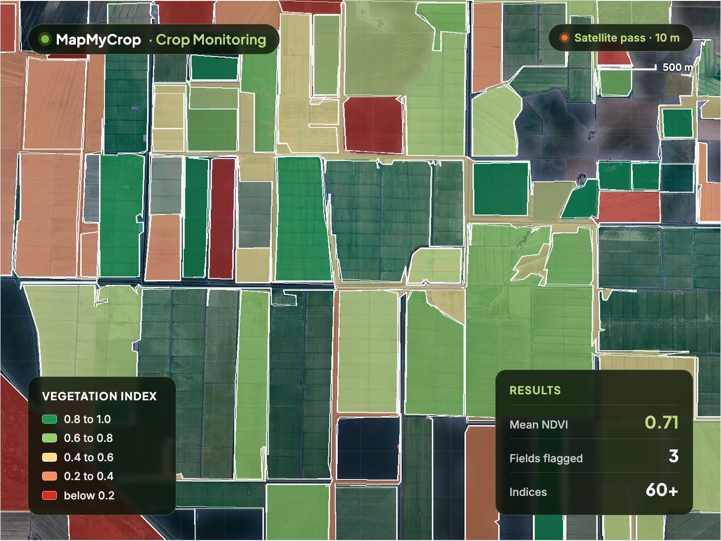
Crop Monitoring
Monitors crop health field by field from satellite data, with advisories while there is still time to act. See stress, growth stage and problem areas from a phone or desktop. For crops only.
Crop Monitoring combines 60+ satellite indices, hyperlocal weather and AI to show how each field is performing, flag problems early and tell the grower what to do next, by app, WhatsApp, SMS or voice call. Built for crops only.
60+ live index layers from 10+ satellite providers: vegetation, chlorophyll, stress, soil, water, topography, nutrient and productivity.
Field-level forecast and history at under 100 m resolution, weather map layers and alerts for damaging conditions.
Plain-language actions from the latest data, sent by app, WhatsApp, SMS and automated voice call in the local language.
Photo-based diagnosis and remedy from a database of 2,000+ diseases, plus alerts when disease or pests appear on nearby farms.
Find problem spots, record observations on the go, and follow a stage-by-stage plan from before sowing to harvest.
Prescription maps for seed, N, P and K as ISO XML and shapefile for ISOBUS machinery, local market prices and agronomist consultation.
Map every farm and field
What is planted, field by field
Water decisions by field
See outcomes before harvest
Spot stress, disease and water problems before they turn into yield loss, and shorten the time from alert to action.
Apply fertiliser and crop protection only where maps show they are needed, with prescription files the machinery reads.
Find hectares that consistently underperform and manage them separately, or change their use.
Check every field from a phone or desktop, with a season record per field to compare yield against earlier seasons.
Track which enrolled farmers receive each alert by channel, and the share of fields with an active advisory.
Advisors serve more farms per season because scouting goes only where the map shows a problem.
It monitors crop health field by field from satellite data and sends advisories while there is still time to act. Each field gets live map layers, growth stage and crop status, a hyperlocal weather forecast, alerts and plain-language actions. It is built for crops only.
Growers, cooperatives and FPOs, agronomy advisors and input suppliers serving many farms, contract farming and procurement teams, and agribusinesses that want a branded farmer app through white label.
Multi-satellite imagery including all-weather sources, turned into 60+ indices from 10+ providers: vegetation (NDVI, EVI and others), chlorophyll and stress, soil brightness and organic carbon, water stress and soil moisture, topography, nutrient and productivity maps. Root-zone moisture and temperature are also estimated by depth.
By app, WhatsApp, SMS and automated voice call, read out in the local language, including Indian languages. Advisories cover irrigation, crop protection, nearby disease and pest alerts, a personalised crop calendar, rotation guidance, local market prices and access to an agronomist for specific questions.
Every MapMyCrop monitoring product includes 60+ remote-sensing indices, compare maps, AI scouting tasks, irrigation and fertigation scheduling, AI advisory, disease prediction and detection, VRA, reports, a help desk and an enterprise dashboard with rankings, expected yield and acreage, alerts and weekly reports.
Crop Monitoring is for crops only. Use Farm Monitoring for farms with both crops and trees (it includes the farm diary) and Plantation Monitoring for tree crops. Farm Boundary Detection maps fields first and Crop Type Detection labels what is planted.
Tell us your region, crops and use case, and we will set up a field so you can see the maps and advisories.
MapMyCrop is used by 7M+ farmers across 80+ countries. Talk to our team about field-level monitoring and advisories for your growers.


