Unlocking the Future of Agriculture: Automated Crop Field Detections with Map My Crop
In the fast-paced world of agriculture, innovation is the key to success. Farmers and scientists are constantly pushing the boundaries, exploring new frontiers, and revolutionizing the way we think about food production. From automated machinery to precision farming techniques, there is no shortage of exciting developments shaping the landscape of agriculture. In this article, we delve into the blooming landscape of agriculture, uncovering the latest advancements and exploring their potential impact. With a focus on sustainability, efficiency, and productivity, we examine how cutting-edge technologies like artificial intelligence, drones, and vertical farming are transforming the traditional farming practices. As we navigate a growing global population and the challenges posed by climate change, the need for innovative solutions in agriculture becomes increasingly important. Join us as we embark on a journey to discover new frontiers in the fields of agriculture and witness the exciting possibilities brought by these advancements. In a world where every acre of arable land matters, it’s essential to stay ahead of the curve and embrace these new technologies to ensure a brighter and more sustainable future for agriculture.
Agriculture is the backbone of our global food system, and innovations in this field are vital for sustainable growth. At Map My Crop, we are revolutionising agriculture with our cutting-edge technology, enabling automated crop field detections. Our goal is to empower farmers with the tools they need to maximise yields, improve crop health, and ensure sustainable farming practices.
What is Automated Crop Field Detection?
Automated crop field detection is a technological advancement that uses satellite imagery, drones, and AI to monitor and analyze agricultural fields in real-time. This technology helps identify various factors affecting crop growth, such as soil health, water stress, and pest infestations, without needing physical sensors.

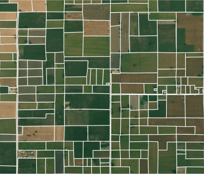
How Map My Crop is Leading the Way
At Map My Crop, we leverage a unique 360-degree imagery agriculture suite to provide real-time data and insights to farmers. Our technology integrates:
- Satellite Imagery: High-resolution images to monitor crop health and growth patterns.
- AI Analysis: Custom AI models that analyze data to detect anomalies and predict potential issues.
- Weather Data Integration: Real-time weather data to help farmers make informed decisions about irrigation, planting, and harvesting.
Benefits of Automated Crop Field Detection
- Increased Yield: By providing timely information and alerts, our technology helps farmers take proactive measures to enhance crop productivity.
- Cost Efficiency: Automated monitoring reduces the need for manual inspections and interventions, saving time and resources.
- Sustainability: By optimizing resource use and minimizing waste, our technology promotes sustainable farming practices.
Real-World Impact
With over 3 million users worldwide, Map My Crop has proven its effectiveness in various agricultural fields. Our platform supports:
- Disease Monitoring: Early detection of plant diseases to prevent widespread crop damage.
- Water Stress Detection: Identifying areas that require irrigation to maintain optimal soil moisture levels.
- Soil Classification: Analyzing soil types to recommend the best crops and farming practices for each field.
Join the Future of Farming
At Map My Crop, we are committed to driving innovation in agriculture. Our automated crop field detection technology is a game-changer, providing farmers with the insights they need to succeed in an ever-evolving agricultural landscape.
Discover how Map My Crop can transform your farming practices. Email us at info@mapmycrop.com to learn more about our services and join the future of sustainable agriculture.