
Water stress and moisture maps
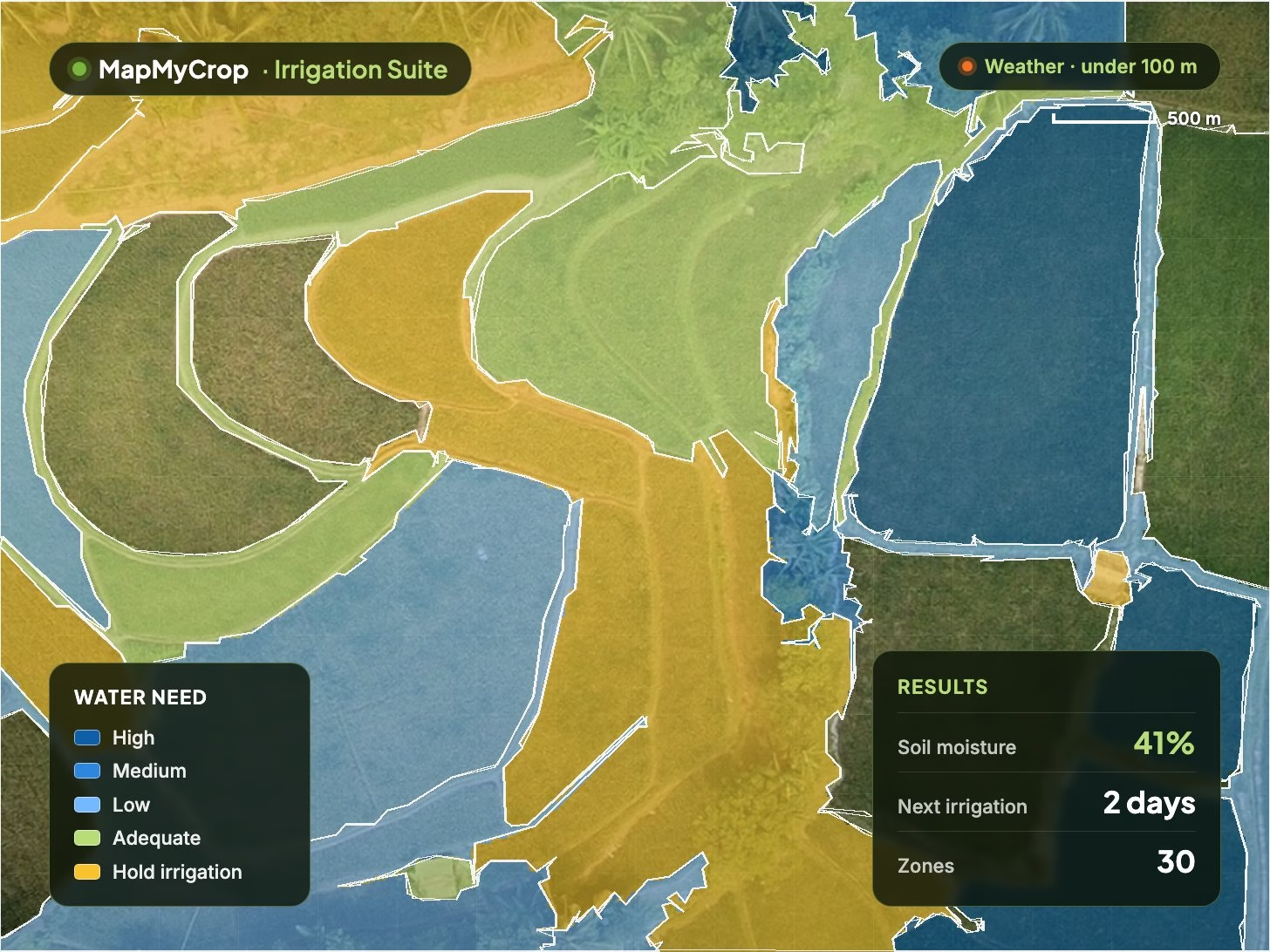
Water stress, soil moisture, soil temperature and plant wetness layers, plus terrain maps of slope, waterlogging and run-off areas.
Map, legend and results in one view.

Irrigation Suite
Helps decide when and how much to irrigate using field-level satellite and weather data. Get a schedule per field, zone volumes and alerts, with no sensors needed to start.
The Irrigation Suite models each field's water need from satellite imagery, weather forecasts, soil and terrain. It outputs irrigation and fertigation schedules, zone volumes, alerts and an efficiency score per farm.
Water stress, soil moisture, soil temperature and plant wetness layers, plus terrain maps of slope, waterlogging and run-off areas.
Daily crop and reference ET from weather and crop stage, with soil, crop type, elevation and permeability in every recommendation.
A schedule per field and growth stage with litres required per management zone and nutrient dosing, ready for smart controllers.
Compare options before committing, get alerts when needs change with forecast rain, and track planned vs actual water weekly.
A 0 to 100 score per farm and period from volume, timing and stress avoidance, with bands from excellent to critical and sub-scores.
Detects irrigation and flood events from satellite without meters; programme dashboards show per-farm scores, zone averages and trends.
Field-level crop health
Map every farm and field
See outcomes before harvest
Water evidence for reporting
Water goes where and when it is needed, so water applied per hectare or per tonne can fall without stressing the crop.
Nutrient doses follow growth stage, and fertiliser applied through fertigation is tracked against plan.
Weekly maps of water-stressed and waterlogged area give time to act before yield is lost or drainage is needed.
Fewer unnecessary irrigation events reduce energy and pumping cost per hectare.
A record of planned versus actual use and yield per unit of water supports sustainability reporting.
Satellite and weather data are enough to begin; sensor and IoT feeds can be added to calibrate the model where present.
It is a tool that helps decide when and how much to irrigate using field-level satellite and weather data. It outputs a schedule per field, zone volumes, alerts and an Irrigation Efficiency Rating per farm. It was previously called the Irrigation Modelling Tool.
Irrigated farms and estates of any size, water user associations and irrigation schemes, government and utility water managers, agribusinesses with water-efficiency targets, and regulators that need to score every farm in a region. It covers field crops and tree crops such as date palm.
Satellite imagery, weather models, elevation and soil data. No sensors are required to start; where sensors or IoT feeds exist they can be added, and an optional ground validation cohort calibrates the model to local soils, crops and climate.
A score from 0 to 100 per farm and period that combines volume efficiency, timing efficiency and stress avoidance, with bands from excellent to critical. Sub-scores show which dimension is failing, and programme dashboards let authorities filter farms against a threshold.
Crop Monitoring shows how crops are performing; the Irrigation Suite focuses on how much water each field needs and when. Water-use records also feed the Sustainable Agriculture Suite for reporting.
Schedules are compatible with smart irrigation and fertigation systems, and scores and dashboards are available through the platform, CSV export and the MapMyCrop API. Contact our team to discuss your set-up.
Tell us your region, crops and water constraints, and whether you manage a farm, a scheme or a regional programme, and we will show how the Irrigation Suite would plan for them.
MapMyCrop is used by 7M+ farmers across 80+ countries. Talk to our team about irrigation planning and water-efficiency scoring for your farms.


