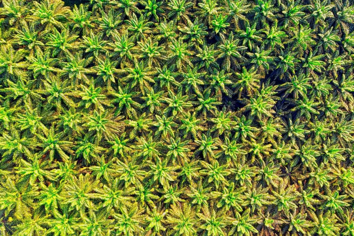
Know the condition of every block, tree and palm
Block health, tree and palm counts, individual tree scores, FFB forecasts and fire alerts for orchards, oil palm and other tree crops, from satellite imagery.
What gets in the way

Condition is judged on routine walks
Estate condition comes from manual census and periodic inspection. Stress and gaps show late, and yield is not known until harvest.

Tree counts and gaps are estimates
Counting trees by hand across large blocks is slow. Replanting and yield plans rest on rough figures instead of a live count.

Harvest and fire risk are hard to see
Ripeness, harvest timing and fire risk are hard to read across a whole estate, so crews, mill deliveries and records are planned late.
Where to start
Orchards and mixed tree crops start with Plantation Monitoring. Oil palm estates start with Palm Oil Monitoring, which adds palm-level and harvest tools.
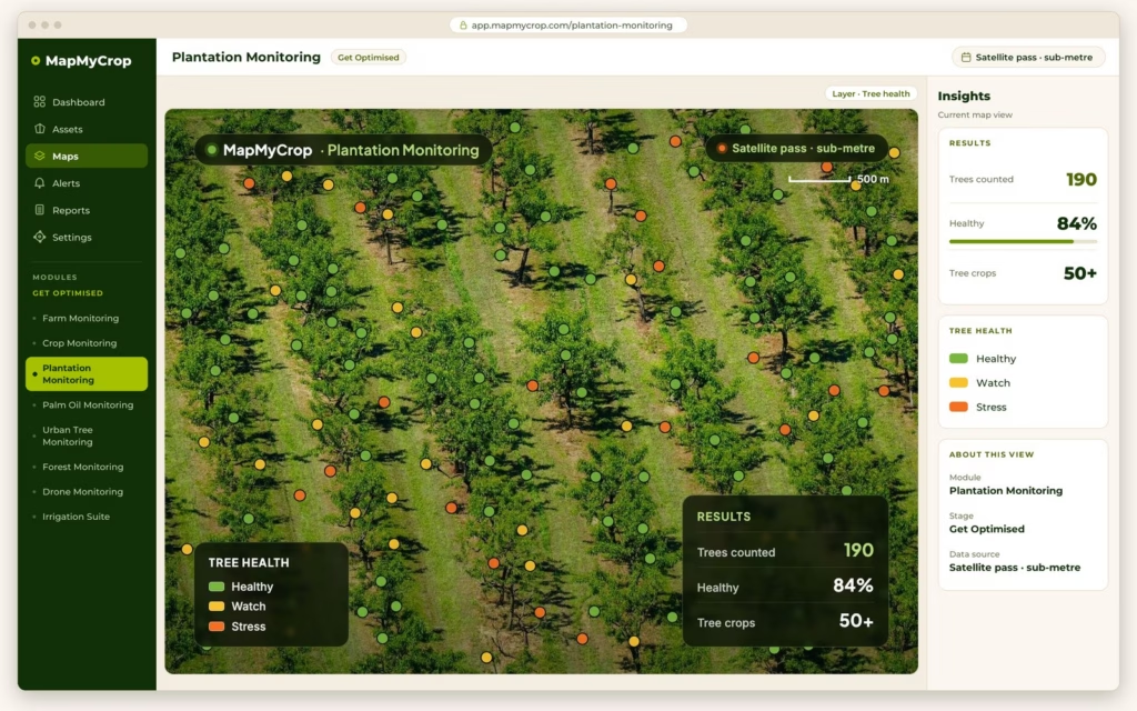
Plantation Monitoring
Monitors each block from satellite and scores individual trees without a drone. It supports 50+ fruit trees, orchards and other tree crops.
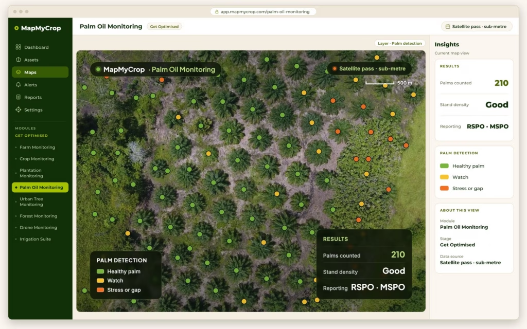
Palm Oil Monitoring
Counts and scores every palm, estimates bunch ripeness, forecasts FFB weight on a rolling 30, 60 and 90 day window, and sends fire alerts. RSPO and MSPO compliant, with an RSPO and MSPO compliance pack in its reports.

Drone Monitoring
Turns your own drone images into maps and models for plant counts, gaps and close-up damage that satellite pixels cannot show. The platform is software; Map My Crop can recommend local drone partners.

Farm Prediction Suite
Estimates yield and harvest timing from satellite data and weather forecasts, so storage, transport and labour follow a forecast.

Irrigation Suite
Models water need per zone from satellite, weather and soil factors, and compares planned irrigation with what was applied. Works for tree crops such as date palm.
From estate to single palm
Palm Oil Monitoring organises the estate in four levels, each with a KPI summary you can open up.
Condition and count, tree by tree
Each tree is plotted as a coloured point over the aerial image, so a manager sees which trees to inspect first. Tree-crown detection finds individual crowns in aerial imagery and identifies species. Plant population from drone imagery gives the number of trees in a block.
Needs inspection
Go and look first.
Declining health
Watch closely.
Moderate
Not yet a concern.
Healthy
No action.
From ripeness to the mill
Count bunches and read ripeness
Bunch counts per block, sorted into unripe, near-ripe, ripe and over-ripe, with a 0 to 100 ripeness score.
Forecast FFB weight
Per palm, per block and per estate on a rolling 30, 60 and 90 day window, adjusted for climate.
Check harvest readiness
A go or no-go per block, and a predicted harvest window.
Plan crews and deliveries
Route optimisation, a harvest calendar and mill delivery schedule sync.
Fire watch inside your boundary
Alerts
Near-real-time hotspot detection inside the estate boundary, sent by SMS and email.
Risk
Dry-season risk zones, with peat and drought overlays.
After a fire
Burn boundary and severity, with an incident log.
Records
A burn-free audit trail for RSPO and MSPO, and a carbon loss estimate from fire.
How it starts
Book a demo
Tell us the crops, the number of estates and what you want to see first. We reply within one business day.
See it on your estates
We walk through the platform with your own location or portfolio and agree the products that fit.
Review the first maps and counts
Look at block health, tree or palm counts and gaps with our team, then switch on forecasts and fire alerts.
See every block before the next harvest round.
Book a demo and tell us which crops and estates you manage. We reply within one business day.